3-Eggen Trail


- 2:20 h
- 12.52 km
- 462 m
- 462 m
- 1,143 m
- 1,517 m
- 374 m
- Start: Mostelberg mountain station
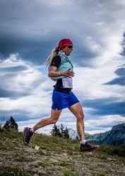
The Engelstock route is very popular with walkers and hikers in both summer and winter. With running shoes and some fitness, it becomes a top-class trail run that connects the smoothest paths between Bannegg, Haggenegg, and Mostelegg. The scenic highlight is the flow trail from Haggenegg to Engelstock with the impressive panoramic view all the way to the Bernese four-thousanders. The route can also be run just as well from Haggenegg or Mostelegg, also in reverse direction.

Good to know
Pavements
- Asphalt (31%)Trail (37%)Path (33%)
Best to visit
- suitableDepends on weather
Tour information
Cable car tour
Circular trail
Refreshment stop
Author
Xaver Büeler
Organization
Schwyz Tourismus
License (master data)
Xaver Büeler

Author´s Tip / Recommendation of the author
This route can be arranged very flexibly, for example by starting already in the saddle (plus 400m elevation) or by combining it with summits (e.g. Spilmettlen, Hochstuckli, or Engelstock). Almost no limits to your imagination.
Nearby
Download GPX file